
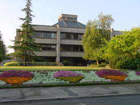
VESTRA worked with the City of Redding to migrate their legacy, high usage Enterprise GIS web applications to modern Portal and Web AppBuilder based web apps. The legacy applications used Adobe Flex technology. Besides developing custom Web AppBuilder widgets that support City business processes, VESTRA performed the upgrade of the City’s ArcGIS for Server from version 10.1 to version 10.3.1. The City made the change to migrate to the latest Esri platform and take advantage of the latest functionalities that it provided.
City of Medford, OR
VESTRA performed the ArcGIS for Server upgrade for the City of Medford. The City upgraded its ArcGIS for Server and Enterprise Geodatabase infrastructure from 10.1 and 10.2. VESTRA performed requirements gathering, upgrade and migration planning, and testing activities. The project also included migrating the City's legacy Silverlight web applications to modern HTML5/JavaScript based web applications, including the creation of custom Web AppBuilder widgets that perform complex querying and reporting (https://gisapps.medfordmaps.org/mli/).
City of Elk Grove, CA

The City of Elk Grove contracted with VESTRA to provide GIS program services to the City including GIS Data, Mapping, Analysis Support and Services; GIS Coordination Services; GIS System and Application Maintenance and Support; and GIS Training Services.
As part of this contract, VESTRA is working with Elk Grove to upgrade their online GIS applications; which can be viewed here.
City of Daly City, CA
VESTRA has been providing GIS upgrade and support services to the City of Daly City for several years. Beginning in 2008, VESTRA provided support to the City to install and configure ArcGIS for Server and ArcSDE. VESTRA staff provided on-site installation, configuration, data migration, application testing support, as well as remote technical support to Daly City staff during the implementation effort. In 2014, VESTRA provided upgrade and support services to upgrade the City’s ArcGIS Servers and SDE to 10.1. Most recently, VESTRA upgraded the City from 10.1 to 10.3.1.
City of Cupertino, CA
VESTRA contracted with the City of Cupertino to provide a comprehensive GIS Master Plan. With a good foundation in place, the City was looking to cast a vision and develop a strategy for how GIS could better serve the City by improving how it is used, implemented, leveraged and integrated as a technology and be highly visible within the organization over the next five years. VESTRA helped the City with a detailed roadmap and a phased implementation plan to meet City goals such as enhancing GIS service delivery with improved efficiency and effectiveness, expanding GIS accessibility and use, achieving a greater level of integration of the GIS with the City’s business systems, provide better support to City business processes, increase organizational awareness, visibility and department sponsorship for GIS, and implementing best in class GIS technology.
City of Columbus, OH

VESTRA worked with the City of Columbus to create a custom widget (Advanced Reporting Widget) developed using Web AppBuilder for ArcGIS. The widget helps users automate reporting workflows with reports generated in PDF format. The tool performs a spatial drill down to generate custom reports with information from multiple map layers.
Click here for more information on this widget, and other custom widgets created by VESTRA.
City of Mountain View, CA

The City of Mountain View implemented an Enterprise Geographic Information System to streamline and improve the current use of GIS within the City.
Services VESTRA has provided for the City::
- Perform a comprehensive needs assessment
- Initial design and development of their Enterprise GIS platform
- Implementation of their Enterprise GIS platform
- Created internal parcel viewer (using Web AppBuilder) - based on Esri's Local Government Information Models (LGIM)
Click here to view the City of Mountain View's public web app gallery.
Click here to read the article about the City of Mountain View published in Esri's ArcNews.
Beef Tracker

VESTRA was contracted by the National Cattlemen's Beef Association (NCBA) to develop the BeefTracker utilizing Esri’s ArcGIS Online web mapping platform as the core foundation for development. The objective of the BeefTracker was to design, develop, and implement a location-based solution for ranchers to document sustainable land practices and to demonstrate that beef production fits within a sustainable ecosystem. The BeefTracker utilizes the latest web-based Geographic Information Systems (GIS) technology, and was designed to provide a robust, but easy to use interface for data collection, editing, and reporting.
The initial design and testing of the BeefTracker was based upon input from NCBA’s project team and a select group of volunteer rangeland researchers and ranchers in various parts of the U.S. The input from the project team and volunteers provided great insight into current livestock operation activities, and how the information entered into the application could be used to demonstrate, and to improve operations over time. Keeping this initial design group small allowed VESTRA’s development team to focus on building core functionality that demonstrated how ranchers could utilize and benefit from GIS technology.
California Department of Water Resources

Utilizing the Department of Water Resources' (DWR) information technology architecture standards, VESTRA’s team developed a Model Conversion Plan that outlined a solution to resolve issues that DWR had with the application prior to any redesign. The plan described the steps required to convert the existing stand-alone GIS methodology to a multi-user GIS solution, improving business workflow processes, as well as scripting of geoprocessing tools, development of custom user interfaces, and deployment of an ArcSDE geodatabase and ArcGIS for Server in DWR's environment.
Following the model conversion plan VESTRA’s team redesigned DWR’s desktop GIS solution to be a multi-use enterprise GIS solution using the ArcGIS for Server and ArcGIS for Desktop 10.2 platform. Following development of the new solution, VESTRA's team implemented, deployed, and trained DWR staff on the use of the multi-user solution.
VESTRA is currently supporting the Department of Water Resources (DWR) with the Geospatial Technical Support project. This multi-year contract involves assessing DWR’s current Enterprise GIS Architecture. Working with DWR’s Division of Technology Services, VESTRA is assisting in reviewing and modifying their standards-based, scalable geospatial infrastructure to provide for interoperable data sharing and enterprise-wide geospatial data processing. Also included in this project is the development of a library of commonly used web and desktop GIS functions for incorporation into future applications.